Why River Valleys Rarely Follow a Straight Line
River valleys rarely follow a straight line because water shifts across the floodplain; learn to separate a river’s current bends from its larger landform.
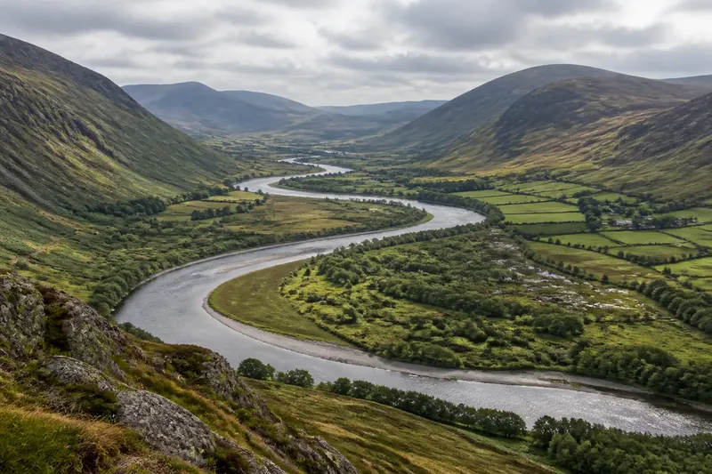
A river on a map may curl across a broad valley, while the valley itself keeps a steadier course through the surrounding terrain. River valleys rarely follow a straight line because flowing water erodes some banks, deposits sediment elsewhere, and gradually changes where the channel runs. To read the landscape clearly, first distinguish the river’s present course from the wider low ground it occupies.
Problem: the river and valley seem to point in different directions
This usually happens because the channel is narrow and changeable, while a valley records a much larger pattern of drainage and erosion. A river can swing from one side of its floodplain to the other without changing the broad direction in which the valley descends.
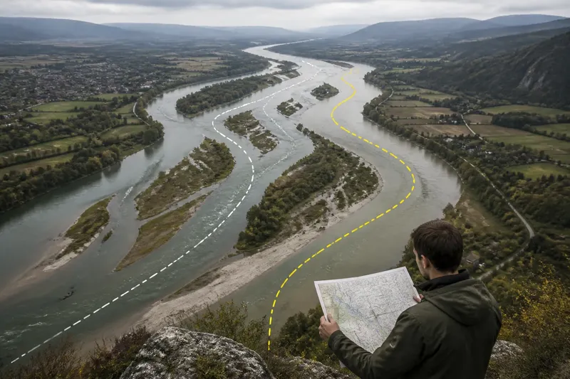
Start with a map that shows both contour lines and the river. Contours form a sequence of V-shaped bends where they cross a stream; the points of the V generally face uphill. Follow that pattern across the whole valley rather than tracing each small river curve. On a terrain view, look for the broad corridor of lower ground between higher slopes.
Then compare the channel with the valley floor. If the channel bends across a relatively wide, low area, it is probably wandering within the landform rather than defining every turn of it. If the slopes close in around the river, the channel may be more tightly constrained, but the valley’s overall direction still comes from the larger drainage route.
Use the valley’s long axis to describe its course and the river’s line to describe its current route.
Problem: a bend looks like a permanent feature
A map captures a river at a particular time, but a bend can migrate. As water moves around a curve, faster flow tends to erode the outer bank, while slower water allows sediment to settle along the inner bank. Over time, this uneven movement can shift the channel sideways and make the curve more pronounced.
Look for signs of that process around the bend. A steep or freshly exposed outer bank may suggest erosion; a gently sloping inner bank, sandbar, or depositional surface may suggest sediment accumulation. These clues describe local activity, not a fixed schedule. Vegetation, floods, sediment supply, and the material in the banks all affect how a river changes.
For a useful comparison, inspect maps or aerial images from different dates, if available. Align them using stable landmarks such as road intersections or bedrock ridges, then compare the channel position. Avoid treating a small difference as proof of a major shift: image scale, season, water level, and map accuracy can all affect what appears to be the river’s edge.
Read a bend as an active part of the channel, not as a permanent boundary in the terrain.
Problem: a map makes the valley look as narrow as the river
At small scales, cartographers often draw a river as a thin line. That symbol can hide a floodplain, terraces, wetlands, and abandoned channel traces. The river line is a representation of the channel; it does not show the full width of the valley floor.
Switch to a larger-scale topographic map or a shaded-relief view. Look for low, gently sloping ground beside the channel and for a break in slope where that ground meets higher terrain. A broad flat surface may be a floodplain; a higher, flatter bench can be a terrace left by an earlier river level. These features can reveal the valley’s shape even where the present channel is small.
Do not assume every flat area beside a river is floodplain. Human grading, agricultural fields, reservoirs, and glacial or coastal deposits can create level surfaces too. Check how the feature relates to the channel, nearby slopes, and drainage paths before naming it.
When the map symbol is too thin to show the landform, let contours and relief carry the interpretation.
Problem: the valley seems to change direction abruptly
A sharp turn in the valley’s broad course can reflect a change in the underlying rock or structure. Harder rock may resist erosion and steer drainage around it; fractures or weaker layers may offer a route that water can deepen. A tributary joining from the side can also complicate the apparent direction of the main valley.
Check whether the turn persists beyond the river’s immediate bends. If the surrounding slopes and low ground turn with the channel, the valley itself likely changes direction. If only the water line turns while the valley floor continues onward, the river may be adapting to a local obstacle, sediment bar, or floodplain feature.
Imagine a map where a river curves around a low ridge, then resumes its former direction downstream. If the broad valley floor also wraps around the ridge, describe a valley bend. If the low corridor stays aligned and only the channel loops around, describe a river bend within a straighter valley. That distinction keeps a local feature from being mistaken for the shape of the whole landscape.
How can you tell which line belongs to the valley?
What should I follow on a contour map?
Follow the repeated pattern of contours and the broad band of lower ground, not just the water symbol. Contour V’s point uphill where they cross a stream, helping you trace the drainage corridor.
Can a river move without changing its valley?
Yes. A channel can migrate across a floodplain while the wider valley remains in the same general position. The valley is the larger landform; the channel is the route water occupies now.
Do all river valleys have meanders?
No. Some rivers are confined by steep slopes or resistant rock, while others follow different channel patterns shaped by slope, sediment, and water flow. A winding valley does not require a winding channel.
Why do old maps show a different river line?
The channel may have shifted, or the maps may differ in scale, survey method, season, or the way the river was represented. Compare stable terrain features before deciding that the landscape itself changed.
What to do when the evidence conflicts
When a river line, contour pattern, and relief image seem to disagree, work from the broadest clues toward the smallest. First trace the low corridor between surrounding slopes. Next identify the present channel and note its bends. Then look for floodplain edges, terraces, tributaries, and possible obstacles that explain where the channel sits within the valley.
For an uncertain feature, use cautious wording: “the river currently follows” for the channel, and “the valley trends” for the larger landform. If the map cannot distinguish a floodplain from another flat surface, describe what is visible rather than assigning a landform name without support.
River valleys rarely follow a straight line, but their broad direction is often easier to read than the water’s latest route. Compare the channel with contours, slopes, and the valley floor, and keep those two scales separate. A map becomes much clearer once the river is treated as a moving line inside a more persistent landscape.