Globe or Flat Map for Comparing Continents?
Globe or flat map for comparing continents? Choose the right view to judge area, shape, position, or routes without mistaking a map’s design for geography.
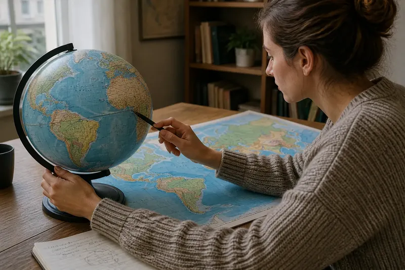
For comparing continents, start with the feature you want to judge: a globe shows their curved arrangement, while a flat map makes names and regions easier to inspect. The difference matters because each view answers a different question, and a flat map’s layout can make far-apart places seem unexpectedly close or distant.
Continent comparisons need a clear question
A globe is useful for understanding how continents sit around the oceans and how landmasses relate across Earth’s surface. A flat map is easier to annotate, share, and scan without turning an object. Neither view is automatically best; the useful choice depends on whether you are comparing area, adjacency, hemispheres, or map layout.
Before looking at either, write the question in a few words: “Which continents border the same ocean?” or “Which crosses the equator?” That keeps the comparison focused on a geographic relationship instead of the visual impression created by a particular design.
Use a globe to see how continents face one another
Turn a globe to follow the ocean between two continents. This makes it easier to see that a world map’s left and right edges are joined on Earth, not separated by a real boundary. It also helps when checking whether two continents sit across a narrow stretch of water or face one another across a much broader ocean.
Mark the equator and the poles as reference points. Then note whether each continent crosses the equator, lies mostly in one hemisphere, or extends toward a pole. A globe is especially helpful for these broad relationships because its surface curves as Earth does.
A globe cannot show the whole planet at once, and small labels may be difficult to read. Use it to understand arrangement, then consult a labeled map for names and detail.
Use a flat map to compare how continents are connected
Flat maps are particularly useful for examining how continents appear within a chosen global layout. Some maps place the Atlantic near the center; others center the Pacific. The choice changes which landmasses appear at the edges, so it can change how easy it is to trace a connection across an ocean.
Look at the map’s boundary and projection information before comparing positions. A map cut through the Pacific may split Asia or the Americas across its edges, while a different central meridian can keep those landmasses visually whole. This is a layout choice, not a change to the continents’ locations.
For a connection question, trace the route of attention: identify the starting continent, follow the named ocean or strait, and locate the destination. If the line disappears at the edge, continue it from the opposite edge rather than treating the frame as a wall.
What map layout changes about continent connections?
Why do some continents appear on opposite sides of a map?
A flat world map has edges, so its maker must choose where to cut the globe before laying it out. If the cut passes through a landmass or ocean route, that feature may appear split even though Earth’s surface continues around it.
Does the map center change which continents are neighbors?
No, but a central meridian changes which relationships are easiest to see at a glance. Compare a Pacific-centered map with an Atlantic-centered one, and check the globe if an edge makes a connection hard to follow.
How can I tell whether two continents share an ocean?
Check a globe or a map with the ocean clearly labeled, then trace the water body along the coasts. Do not infer a shared ocean from apparent closeness alone; a narrow strait, island chain, or map edge can complicate the visual impression.
Why do maps show different continent boundaries?
Maps may follow different conventions for where a continent ends, especially where land connects across an isthmus or broad region. Check the map’s legend or source, and use the same convention throughout a comparison.
Compare Africa and South America by tracing their Atlantic connection
Imagine you are preparing a classroom map and want to show how Africa and South America face one another across the Atlantic. Your starting materials are a globe and a Pacific-centered flat world map. First, turn the globe until both continents and the Atlantic are visible; note that their facing coasts border the same ocean. Next, find those coasts on the flat map and trace the Atlantic between them. If one coastline sits near an edge, switch to an Atlantic-centered map or continue the trace from the opposite edge. The result is a clearer comparison of their ocean-facing positions, without suggesting that the map frame separates them.
For a quick check, use these observations to choose your next action:
- Observation: The comparison asks which continents border the same ocean. If: Both appear along a labeled ocean, then trace its coastline on the map; otherwise: check a globe or a map with that ocean centered.
- Observation: A continent is split at the map edge. If: the map shows the same landmass continuing on the opposite edge, then follow it across the frame; otherwise: check a globe before treating the split as real.
- Observation: The map’s center hides a route between continents. If: another map centers the relevant ocean, then use that layout; otherwise: trace the route on a globe.
- Observation: The question concerns whether a continent crosses the equator. If: the equator is marked, then compare it with the continent’s outline; otherwise: select a map or globe that marks latitude.
- Observation: Two maps use different continent boundaries. If: their legends explain the conventions, then apply one convention consistently; otherwise: avoid combining their outlines as though they match.
- Observation: A route seems to stop at the edge. If: the map is a global view with opposite edges representing a continuous surface, then continue the route across the frame; otherwise: consult the map source to understand its coverage.
Pick the view that fits the relationship you want to explain
Use a globe to check how continents face one another, how oceans wrap around the planet, and whether a landmass crosses the equator. Use a flat map to read labels, trace connections in a chosen layout, and show the whole mapped area at once. If an edge, center, or boundary convention changes what you see, compare another layout before deciding what the map says.
For comparing continents, name the map’s center and edge whenever they affect your explanation. That small detail tells a reader whether an apparent gap or split belongs to Earth’s geography or to the way the map was arranged.